

Access comprehensive development plans across selected regions overlaid on satellite imagery for visualization. Essential for real estate developers, valuers, and urban planners to visualize zoning, analyze land use, and make informed decisions.


GIS is a powerful technology that combines maps with data to help you visualize, analyze, and understand geographic information. It creates smart maps that show relationships, patterns, and trends in your data.
Our apps overlay official development plans and custom maps directly onto Google satellite imagery, allowing you to see exactly how planned developments relate to the current landscape.
Using GPS integration and precision georeferencing tools, our apps provide accurate location understanding and allow you to transform any map into a georeferenced overlay.
Comprehensive GIS tools for urban development analysis
Explore comprehensive development plans with satellite overlay
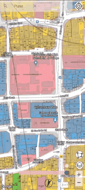


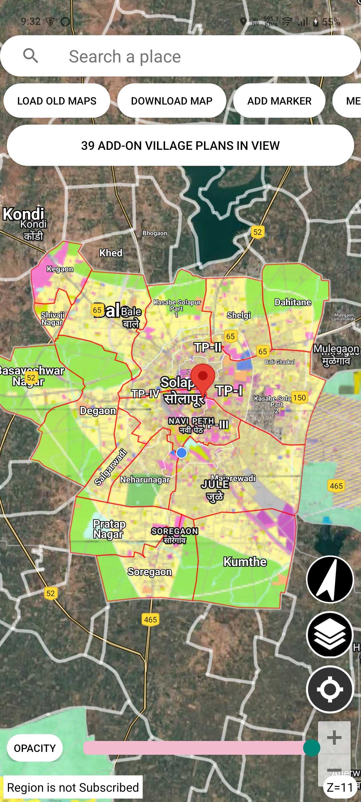
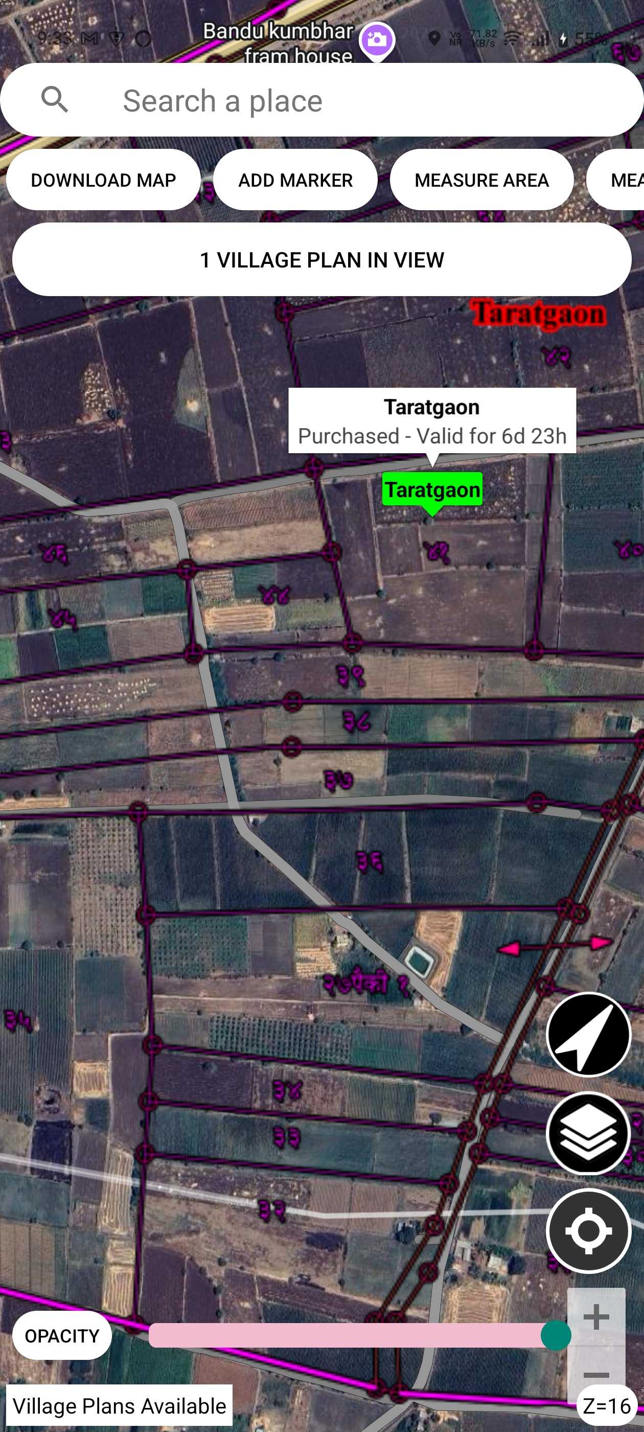
Satellite imagery overlay with high-resolution maps for visualizing development plans
Calculate area and distance directly on interactive maps with precision
View residential, commercial, industrial, and special zones at a glance
Essential for real estate developers, valuers, investors, and urban planners
Access development plans for 157+ locations across India

Desktop-grade precision georeferencing on your Android device
Full guide: Overlayr — map overlay tool & mobile georeferencing app for Android →
Professional georeferencing with precision control points


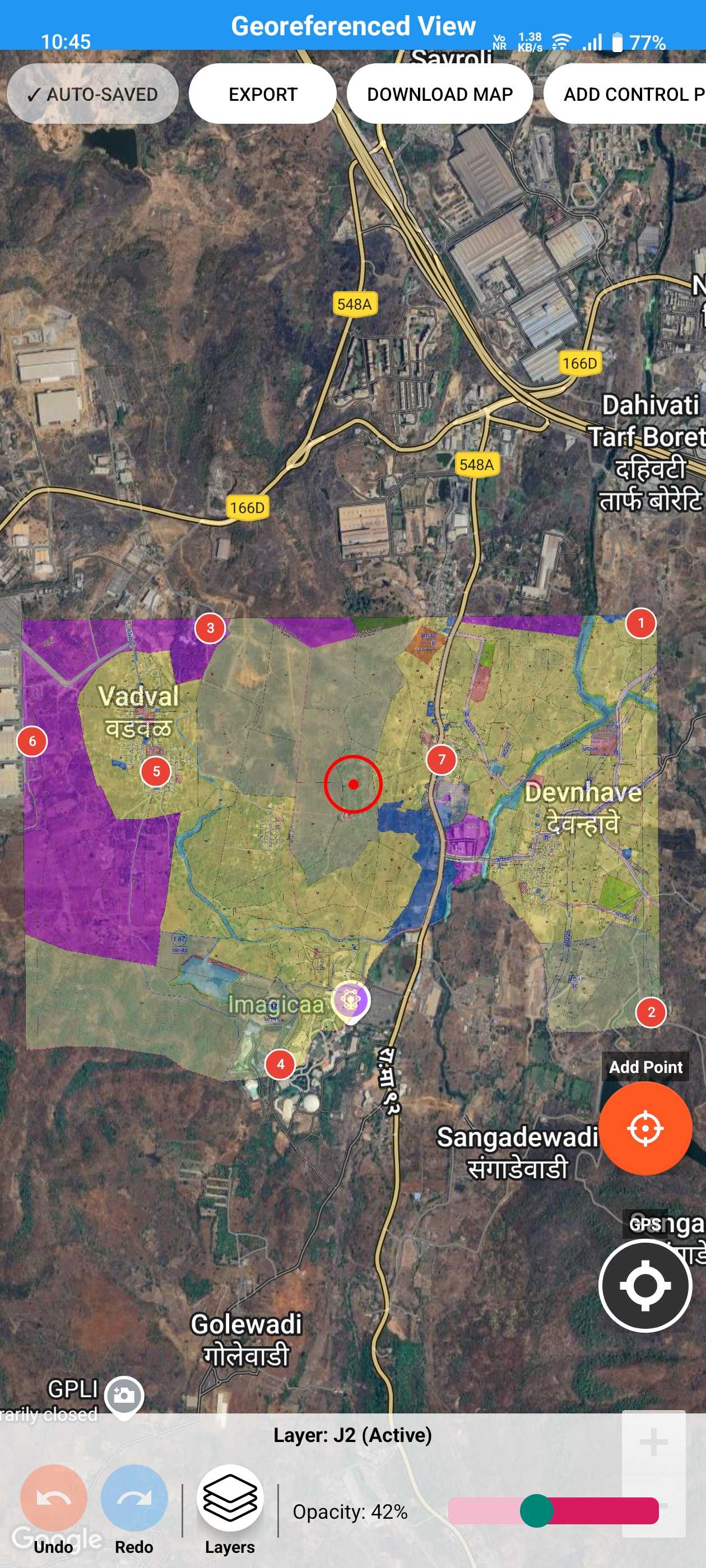

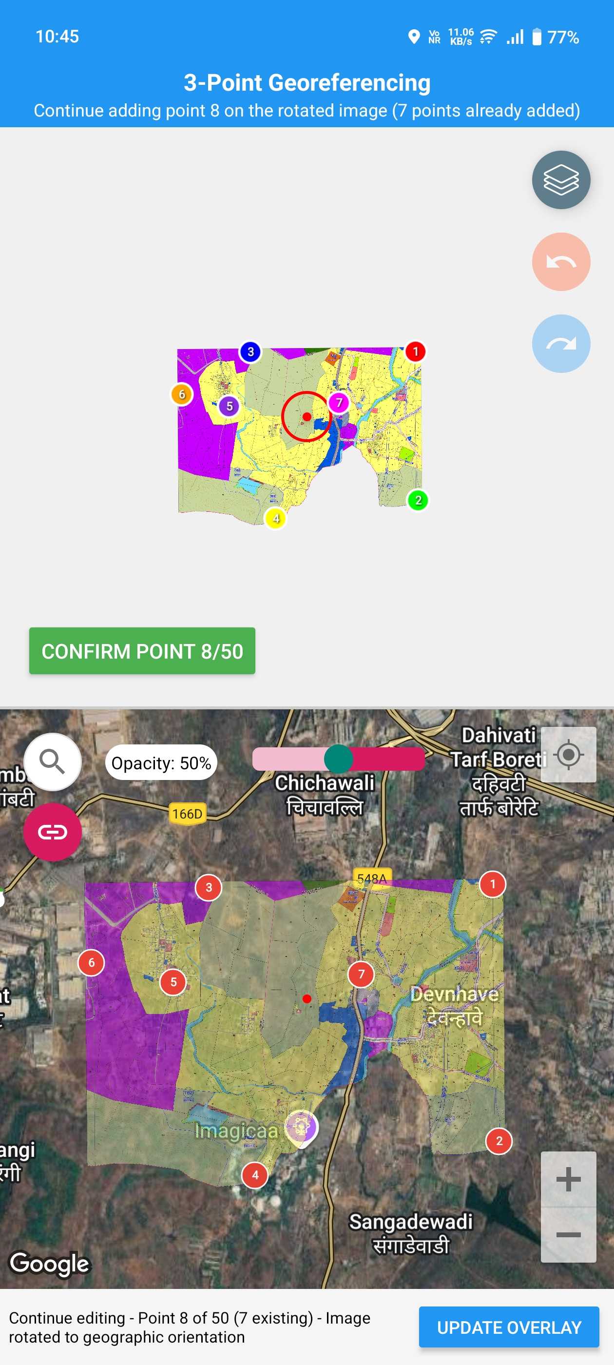
Precision control points with magnified views, live overlay transformation, drag & drop accuracy, and transparency controls for seamless blending
High-res satellite imagery, smart location search, GPS integration for auto-location, and custom markers with labels and details
Area calculation in m², hectares, acres, distance measurement tools, live calculations with instant feedback, metric and imperial support
Export as KMZ for Google Earth & GIS software, high-res screenshots, easy sharing via email and cloud apps, industry-standard formats
Supports JPG, PNG, PDF formats, high-resolution image handling, offline capability, memory optimized for large files
Unlimited projects with Premium, auto-save protection, organized project library, instant loading and resuming
Overlay survey maps on satellite imagery with precision control points for accurate field verification and boundary marking
Visualize development plans on live maps, assess zoning changes, and present proposals with professional overlays
Map field areas, habitats, and ecological zones. Document environmental changes with georeferenced overlays
Mark property boundaries and zoning plans, create professional presentations for clients with accurate overlays
Overlay site layouts and building plans on location for better project planning and coordination
Visualize evacuation routes and response zones, plan emergency services deployment with georeferenced maps
Desktop-level precision on your Android device with advanced georeferencing algorithms
Intuitive interface that makes professional georeferencing accessible to everyone
Stable and tested on thousands of devices with frequent updates and new features
Professional georeferencing tools for surveyors, planners, and GIS experts
Create professional location plans, site maps & property layouts from your phone
Full guide: Location Plan Maker — site plan & location map maker app for Android →
Whether you're a real estate agent rushing between site visits, a civil engineer preparing a client report, or a surveyor documenting a plot — you know how painful it is to create a clean location map. Most professionals still rely on screenshot-and-annotate workflows or expensive desktop GIS software that's overkill for a simple location plan.
Location Plan Maker Pro changes that. It puts a full-featured location plan studio right in your pocket. Open the app, drop markers for nearby landmarks, draw roads and plot boundaries, measure distances and areas, and export a polished, branded PDF — all in under 10 minutes, right from the field.
The output isn't a rough sketch. It's a clean, professional-grade map with proper markers, labels, measurements, and your custom logo — ready to attach to a listing, embed in a report, or present to a client. No internet required after the initial map load. No learning curve. Just open, create, and deliver.
Professional location plans created directly on your phone


Create location maps for property listings that show nearby amenities, roads, and landmarks. Clean maps increase buyer trust and boost conversions.
Generate professional site plans during field visits. Attach accurate, branded maps to your reports without going back to the office.
Deliver polished map outputs that impress clients. Add your logo, customize styling, and present plans that build trust and credibility.
Skip the desktop GIS tools and expensive licenses. Create professional maps directly on your phone with an intuitive, purpose-built interface.
Don't wait until you're back at the office. Open the app at the location, use GPS, drop markers, and export a finished plan in minutes.
Clean designs with branding support, accurate measurements, and polished visuals. Suitable for reports, documentation, and client presentations.
Fast, accurate, and client-ready maps from your phone